↓
 

Travels with George and Marta

Journeys in the Botanical World

Travels with George and Marta
  • Home
  • About
  • Travels
    • Australia
      • Perth
      • Midwest of Western Australia
      • Kalbarri to Narrogin
      • The Great Southern Region and Albany
      • Margaret River
      • Sydney
    • Borneo
      • Kota Kinabalu
      • Nepenthes at Mesilau
      • Rafflesia at Poring Hot Springs
      • Danum – Borneo Lodge
      • Kuching
      • Bako
    • California
      • Anza Borrego – March 2006
      • Los Angeles Gardens April 2008
    • Chile
      • Chile Santiago
      • Chile Atacama
      • Chile Lake District
      • Chile Patagonia
    • Namibia
      • Waterburg and Etosha
      • Etosha and Erongo
      • Welwitschia and Sossusvlei
    • South Africa
      • Kirstenbosch Gardens
      • Bushmans Kloof – Part 1
      • Bushmans Kloof – Part 2
      • Springbok
      • Richtersveld
      • Nieuwoudtville
      • Cape Town Part 1
      • Cape Town Part 2
Home - Page 17 << 1 2 … 15 16 17 18 19 … 100 101 >>

Post navigation

← Older posts
Newer posts →

Big Island – Pu`uhonua O Hōnauna

Travels with George and Marta Posted on November 2, 2012 by MartaNovember 2, 2012

Pu'uhonua o Honaunau

Day 2 – Exploring around Keauhou – October 18, 2012

We were awake before dawn. There is a three hour difference in time between the west coast and Hawaii so we were wide awake by 5:30am. It is actually a good thing. There is about 12 hours of daylight usually from 6am-6pm so an early start makes the most of your time.

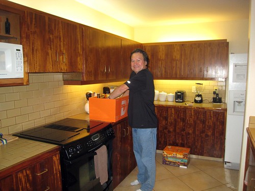
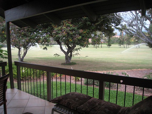
We relaxed over breakfast on the lanai. Scrambled eggs, toast, coffee, juice and wonderful fresh fruit – pineapple, papaya and banana. The magpies chattered and we watched the colorful array of birds.

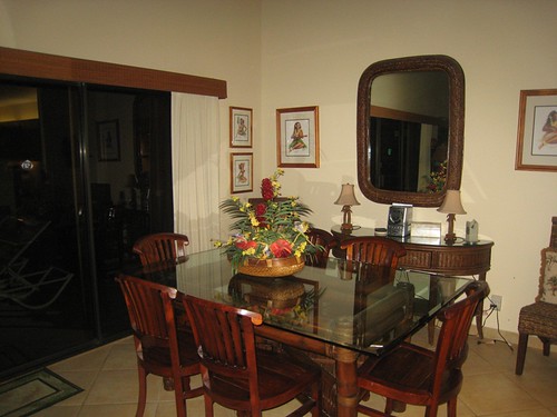
We did a quick walk around the complex. The Ocean pool is beautiful. The complex is on the rocky lava shore and there is a small pool that overlooks the crashing waves. We also went for a walk along the seawall. There are two other pools; one for families and a quiet pool for adults only.

We make a call to Leilani Nepenthes to make an appointment to visit. We suggest Friday at 11:00 and it is arranged. We decide to explore the local area. Pu`uhonua O Hōnauna (City of Refuge) is just a short distance south of Keauhou. We drive along Hwy 11 and turn off at Napoopoo road. It is narrow and winds through coffee, papaya farms. We love the tropical trees and plants that line the road. After a short while, we turn onto lower Napoopoo Road and head towards Kealakekua Bay. I notice a farm stand along the way. It is a plumaria farm and they are selling leis for $3.00. I make a note to come back this way.

The small village around Kealakekua Bay looked interesting. I wanted to check out the bay but there is very crowded at noon. We see little parking and it looked like someone was collecting for entry/parking at the park. We decide to continue on to Pu`uhonua O Hōnaunaand turning on to Puuhonua Road.

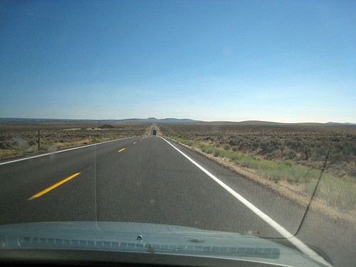
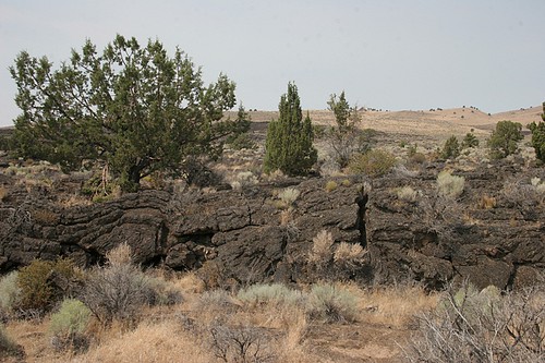
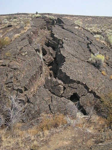
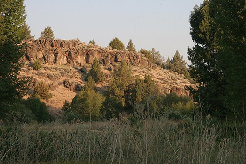
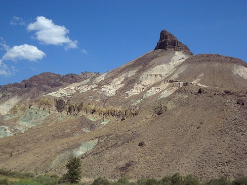
What a contrast! Suddenly we are transported from the coffee plantations to the stark emptiness of a black lava flow. The road is straight and narrow up into the horizon and beckons us to continue – more to escape the starkness.

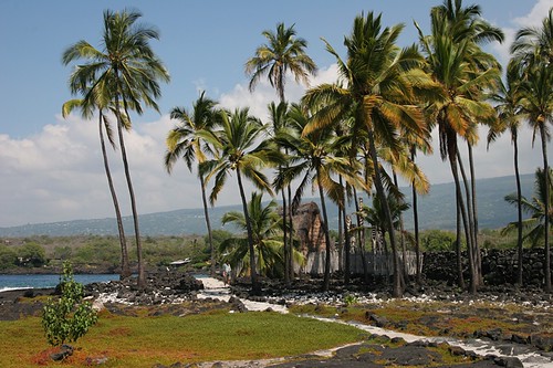
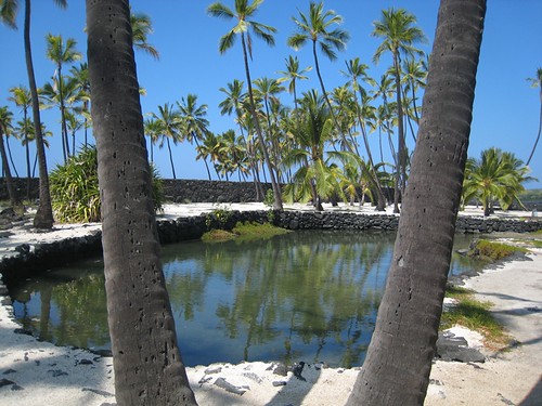
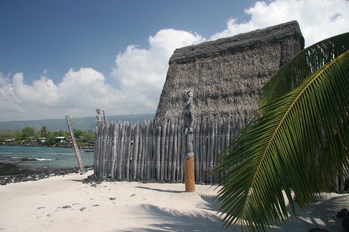
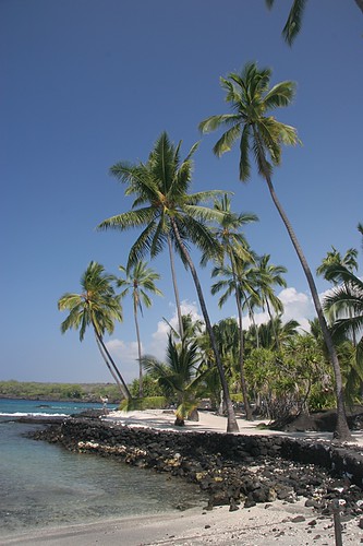
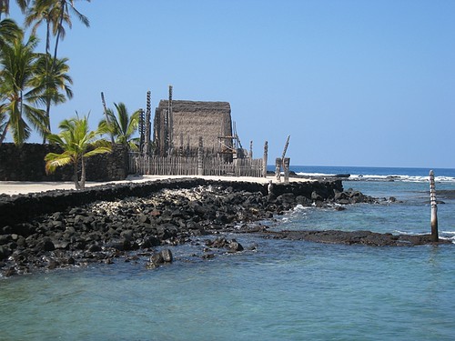
The road takes us to the turn off to Pu`uhonua O Hōnauna and we make good use of our America the Beautiful Pass. It covers the $5.00 fee for parking and entrance.

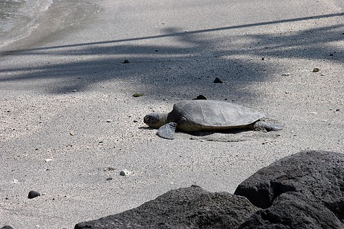
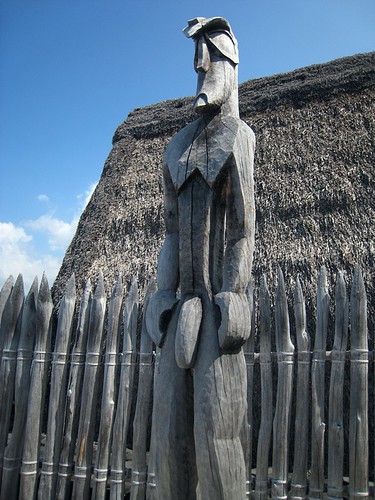
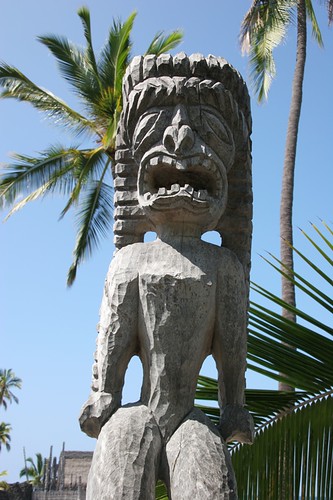
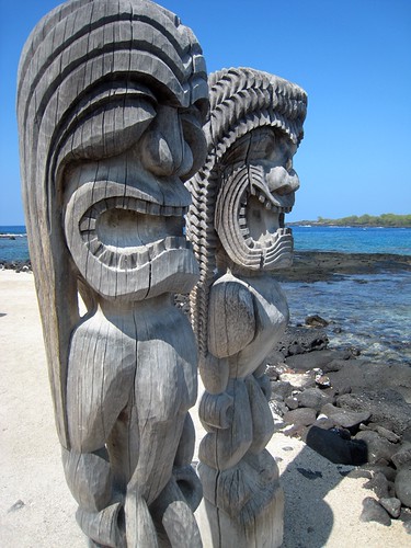
I loved slowly walking around the site and reading the Park service brochure. It was a place of refuge and forgiveness for people who had broken laws. It is also a burial ground and royal grounds. It is also very beautiful.

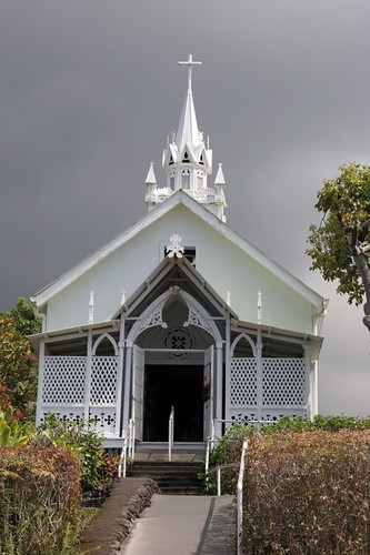
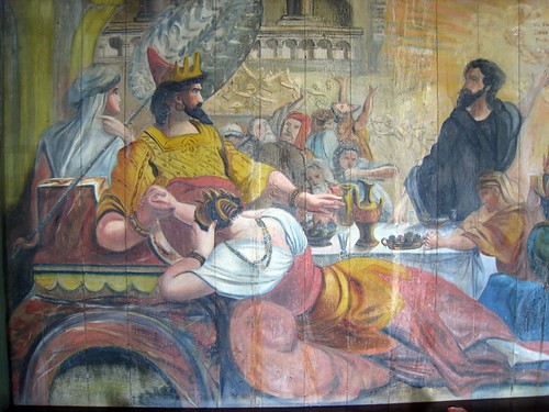
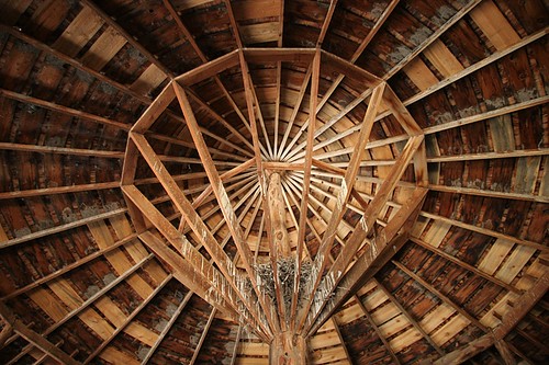
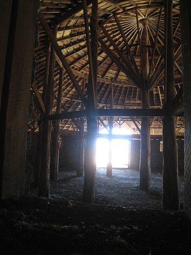
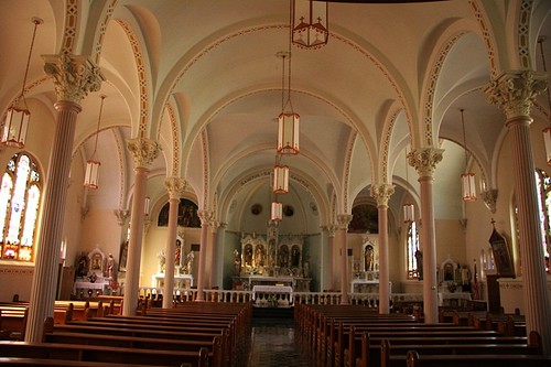
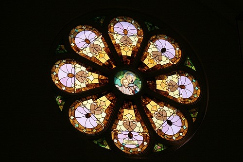
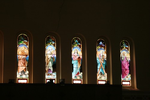
We continued up towards Hwy 11 to stop at the Painted Church. It is a small Catholic Church built in 1899. The walls were painted to teach Hawaiians the Catholic religion. The two sites give so much background into the spiritual lives of Hawaiians.

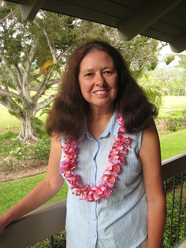
I remembered the farm stand with the leis for sale so we traveled back so I could buy one. There was a cooler where you could select a lei and a honesty box to pay. They were in pretty good condition and we put it in our cooler to keep until we returned to the condo.

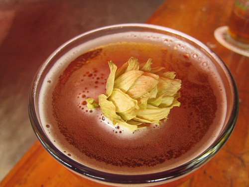
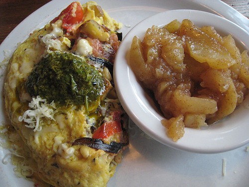
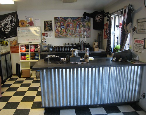
We were hungry and it was about 1pm. It did not take long to tour both of the sites. We decided to head back to Kona to go to Kona Brewing. We found it after one or two wrong turns and of course there was a group waiting. But also many people leaving. We only had to wait about 15 minutes and got a seat outside.

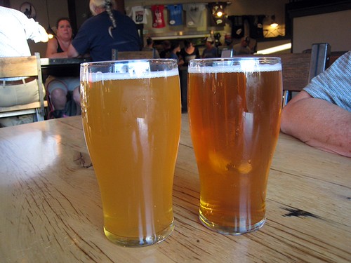
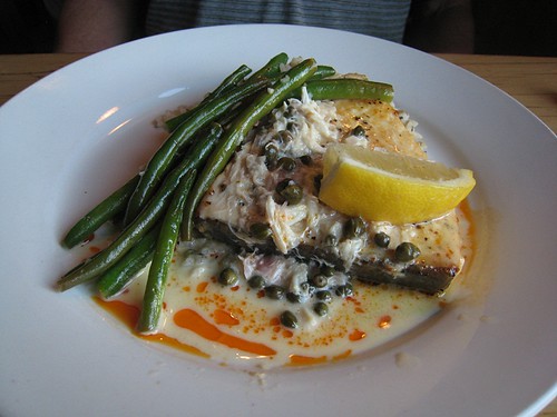
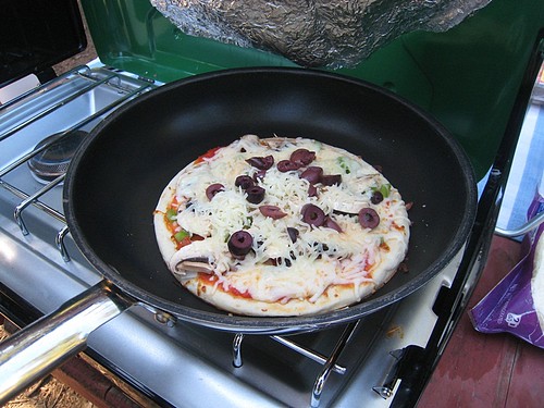
We had a couple of the locally brewed beers that they did not bottle. Kona does much of their brewing and bottling on the mainland because of the cost to transport supplies and ingredients to the island. So that case we got at Costco was probably brewed in Woodinville just about 15 miles from where we live! G had a Castaway IPA and I had a Hula Hefeweizen. For lunch, I had a marlin sandwich and G a pizza. Later we split a fresh hopped season ale which was very tasty. Similar to an IPA but you could really tasty the tangy astringent flavor of the hops.

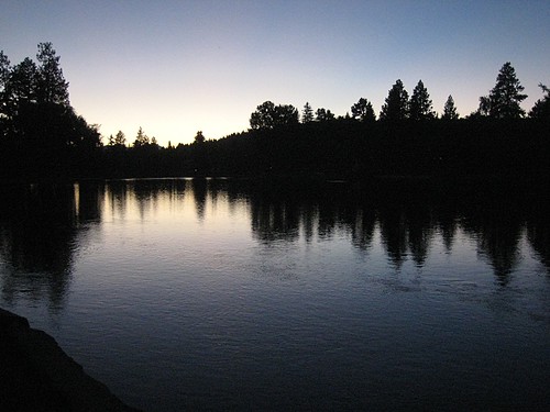
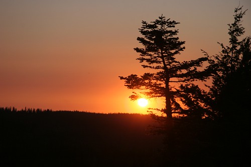
We went back to the condo, relaxed a little and went for a late afternoon swim in the Ocean pool. It was overcast so no sunset but a great way to end the day.


Pu'uhonua o Honaunau

Pu'uhonua o Honaunau

Turtle at  Pu'uhonua o Honaunau

BI_MARTA 037

Pu'uhonua o Honaunau

Pu'uhonua o Honaunau

IMG_0792Two ki'i guardians at Pu'uhonua o Honaunau

Pu'uhonua o Honaunau

Painted Church

Painted church

Kona brewing growler shack

Fresh Hops at Kona Brewing

Lovely lei

Posted in Hawaii | Tagged BigIsland, Hawaii, NaBloPoMo | 1 Reply

Big Island – Arrival in Kona

Travels with George and Marta Posted on November 1, 2012 by MartaOctober 11, 2014

I need a spur to get back to blogging. It is November and time for the NaBloPoMo – National Blog Post Month at BlogHer. It is the push I need to do some blogging and get my travels recorded.

To start, let me tell you about our recent trip to the Big Island in Hawaii.

Day 1 – Arrival in Kona – October 17, 2012

We had timed our trip to Hawaii right as far as weather in Seattle. The fall had been glorious and felt a lot like summer until just a week before our trip. The temperatures had cooled and the daily gray mist had returned. It was a pleasure to think of a week of tropical temperatures.

Our flight left just before 9am which meant we didn’t have to get up in the middle of the night. It takes us about 35 minutes to drive to the airport and about another 10 minutes from parking so we left about 6:30 and we were at the airport by 7:30 easily. We decided to pass on another cup of coffee and headed out to gate where they were just getting ready to start boarding.

The Hawaiian flight was full. We were to get breakfast on the plane but we should have gotten a sandwich instead. It was terrible. It was basically a bagel like roll, cream cheese and guava jelly. The dried tropical fruit was fine.

The flight to Honolulu took about 6 hours. I read my e-book and slept a bit so the trip went somewhat quickly. They served us a Mai Tai before we landed so we were in a good mood.

We had a 2 hour lay-over in Honolulu which gave us time to move between the main terminal and the inter-island terminal. We were hungry and the choices at the inter-island terminal were not much better than the plane; an American hot plate (beef and gravy), Burger King, Chinese Steam table and the bar with a menu that had no prices. G doesn’t eat meat so we went with the Chinese steam table – bad move. It was over cooked vegetables and mystery meat for me. The noodles were fine.

The trip between Honolulu and Kona was easy – about 45 minutes in a Boeing 717. Fortunately our carry on fit on it. It is actually not that small of a jet unlike some of the other small jets like the Canadian models.

Landing in Kona is very different. The guide books warn you but you really do not fully imagine what it is like to look out the window upon miles and miles of black asphalt looking lava. Where exactly am I?

The airport is pretty small and it was easy to just follow the crowd out and to the shuttle to car rentals. We got our car from Avis since Costco had a deal with $35 off and low price – $225/week for a compact. No one else was there which was also great. Everyone had headed to Alamo where we usually rent.

We were off. G was navigating and our first stop was the Costco just about 2 miles from the airport before getting into Kona. You definitely need to have the “Big Island Revealed” guidebook to find it since there are no signs. Or do as I did – just follow the other cars.

Stopping at Costco has its pluses and minuses. It has a good selection and excellent prices – but the quantities are almost too large for 2 people staying a week. We picked up milk, POG, eggs, beer, bread, Mai Tai premixed, a salad for dinner, shrimp poke, chips and an opah filet. On hindsight, we could have used less milk since we had eggs for breakfast instead of usual cereal and we probably would have preferred not be limited to Kona beer for a week. I really wanted to try a couple of the other local beers but the case was going to last the week.

The traffic was pretty slow. It was probably ‘rush hour’ – almost 5pm – plus there was a huge cruise ship in port. It was about 30 minutes through Kona to our turn off to Keauhou and down to our condo. One more stop – at the Keauhou shopping center and the ATA for smaller items, like rice, butter, jam, cheese, etc .

We found out condo on Aloha Condos. I had used them for our rental in Maui two years ago and I really like their website. The site has lots of details and most importantly photos and videos of the condos. Each is privately owned so the decor is different. It is also very easy to use website.

We choose unit 203 at Kanaloa at Keauhou. It did not have an ocean view but instead a view to the golf course which was very quiet and relaxing. The birds in the morning on the fairway were enchanting. I loved the decor and it was exactly as shown on the website. It had everything we needed and was very clean and lovingly tended by previous guests. There were also nice touches such as an excellent welcome basket with lots of local fruit. Besides having a well stocked kitchen, it also had everything you needed for days at the beach. The bed was super comfortable and very fast internet. We felt it was also an excellent deal given the accommodation, location and facilities.

The only thing a little disappointing was the weather. It was overcast and pretty humid. Oh well… you can’t have everything. We unloaded and relaxed in preparation for our week.


Condo - Kanaloa at Keauhou
Living room

Condo - Kanaloa at Keauhou
Dining area

Condo - Kanaloa at Keauhou
Kitchen

Condo - Kanaloa at Keauhou
Lanai in the evening

Condo - Kanaloa at Keauhou
Breakfast on the Lanai

Posted in Hawaii | Tagged BigIsland, Hawaii, NaBloPoMo | 2 Replies

Kona on the Big Island

Travels with George and Marta Posted on October 16, 2012 by MartaJuly 14, 2014

We’re heading for the Big Island tomorrow. It will be good to get back to Hawaii and to see a new island. We are staying for a week at this condo at Kanaloa at Kona. No view of the ocean this time but it looks to be very well equipped. The owners have been great to work with.

We hope to do a little bit of hiking such as Kilauea Iki trail across the dormant volcano crater. Of course we will also take in a garden or two including the Hawaii Tropical Botanical Garden. A lot of sightseeing and eating local.

Aloha!

Posted in Hawaii | Tagged BigIsland, Hawaii | 2 Replies

Page Springs Campground – Steens Mountains

Travels with George and Marta Posted on October 4, 2012 by MartaJuly 14, 2014


Page Spring Campground - Steens Mountains

August 22, 2012

Wednesday, we headed for the Steens. Highway 20 is a long rolling highway east to Burns. We didn’t make too good of time because of a lot of slow trucks and difficulty passing in the little Honda hybrid. We topped the tank in Burns – $4.09. It was going to be the last cheap gas in a while.

We exited Hwy 20 and started south. The signs pointed towards Winnemucca Nevada. Reality hit us – we would soon be close to Nevada.

We dropped into the Malheur basin, one of the premier bird spots in the US. We spotted pelicans floating in the lake and mother grebes with their babies on their backs. Soon after we kept an eye out for signs for Diamond. We wanted to check out the Pete French round barn where the earlier settler, cattle baron Peter French trained his horses in the winter. This was mostly BLM land and we traveled through Diamonds Crater volcanic area, one of the premier basalt volcanic area in the nation. To us, it looked a lot like asphalt. But we did see a pretty group of pink monkey flowers growing out of the lava gravel.

The barn was very interesting and amazingly construction. You truly got a sense of how remote this area is in Oregon. You wonder what it was like to live in the area at the turn of the century.

We continued on to Frenchglen. This is one of the bigger ‘towns’ and it basically consisted of about a dozen houses and businesses. The Frenchglen Hotel is on the register of Historic places. We did spy an ice machine which was going to be very important. We were spending 3 nights and the temperatures were near 90. We knew our block of ice wasn’t going to last more than maybe another day.

We turned off and headed for Page Springs Campground. It sits along the Donner river. We talked to the camp host and he recommended a couple of places that would have shade late in the afternoon which would be important for us in a tent. One spot was in a grassy field – open but lots of room. We took it. We arrived about 2:30pm about a 4 hour drive even with the detour to the barn. Unfortunately the Steens Mountains were cloaked in a smoky haze from the wildfire along the Nevada border.

We set up camp and relaxed in warm shade before a hearty dinner of pasta. A couple of cool beers and it was time for bed.


Hwy 20 from Bend to Burns Oregon
The long road east – Highway 20 to Burns

Diamond Craters - Oregon
Diamond Craters

Diamond Craters - Oregon
Basalt formation at Diamond Craters – doesn’t it look just like asphalt

Mimulus bigelovii – Bigelow's Monkey-flowe
Mimulus bigelovvi growing in the lava rock

Pete French Round Barn

Pete French Round Barn

Pete French Round Barn

Pete French Round Barn

Pete French Round Barn

Pete French Round Barn

Page Spring Campground - Steens Mountains
Page Spring Campground

Posted in Pacific Northwest | Tagged Camping, Oregon | Leave a reply

Exploring Bend Oregon

Travels with George and Marta Posted on September 29, 2012 by MartaSeptember 29, 2012


Boneyard Brewery Bend
T-Shirts of their brews at Boneyard Brewery

August 21, 2012

Tuesdays we decided to play tourist in Bend. We went to breakfast at the Victorian Cafe. Its web site touted it as the ‘best breakfast in Bend’ and it was very good. We had a couple of yummy egg dishes including an Mediterranean omelet with Moroccan chermoula sauce.

We headed to the High Desert Museum. We started with the ranger talk on desert plants where we learned that a grove of quaking aspens is really one plant connected by the root system. Next we toured the Miller Family Ranch; a re-created 1904 family ranch where live actors portray the family. It was interesting to talk with Mrs. Miller who explained how they came to homestead their ranch, their local doctor who was selling several potions and the local school teacher who was visiting the ranch for a home class. It was kinda surreal but very cool and informative,

We went also to the Raptors of the Desert Sky show where captive hawks and falcons would fly through the forest and audience. It was great show. I loved the owls.

After the museum, we cruised through the Old Milltown area. This is a large outdoor shopping center where your favorite large corporate chain store is located. I saw a few local stores but most of the stores were the usual ones you would find at your local specialty mall. We passed. and continued on to Boneyard Brewery for a tasting. It was our favorite brewery. It felt a lot like brewer meets roller girl. They only had two brews on tap but both were tasty especially for $1.00 for a tasting (2 – 4oz tastes). We got a half growler of the IPA and returned to the cottage.

For dinner we walked to 10 Barrel Brewery which was located across the river but not far from the cottage. Again, it was almost an hour wait at 6pm on a Tuesday. Bend is super busy during the high summer season. The food was excellent as were the beers. I had the grilled lamb chops which came with mashed yams and G had the swordfish. After dinner, we walked along the river again and watched the moon come out in the desert sky.

Great Horned Owl
Great Horned Owl at High Desert Museum

Barn Owl
Barn Owl at High Desert Museum

Barn Owl
Barn Owl in Flight

Moroccan Omelet - Victorian Cafe Bend
Moroccan Omelet at Victorian Cafe

Boneyard Brewery Bend
Boneyard Brewery Tasting Room

10 Barrel Brewery Bend
Two brews at 10 Barrel Brewery

Swordfish - 10 Barrels Brewery Bend
Swordfish at 10 Barrels Brewery

Moonrise over Deschutes river
Moonrise over Deschutes River

Posted in Pacific Northwest | Tagged Beer, Birds, Oregon | Leave a reply

John Day Fossil Beds

Travels with George and Marta Posted on September 28, 2012 by MartaSeptember 28, 2012


Painted Hills - John Day Fossil Beds
Painted Hills – John Day Fossil Beds

August 20, 2012

Monday we were up early and had our breakfast in the cottage. We brought along most of our food since we were going to be camping after our stay in Bend. Around 9am, we headed out for John Day Fossil Beds. I have seen some stunning pictures of the unusually colored and shaped hills in the monument. It is not really along the way to anywhere. We thought about stopping on the way back but realized it would not work out. So we decided to do a long day trip from Bend.

It is about 70 miles from Bend to the park Headquarters. From Bend, the road crosses the high desert juniper forest with the volcanoes peaks of the Cascades to the west before turning east at Prineville and climbing up into the Ochoho National Forest. The road was lightly traveled and very interesting. We arrived at the Sheep Rock Visitor’s Center just around noon.

The museum is the headquarters of the paleontology research in the monument. There is a wonderful museum detailing the fossils that have been found – many over 40 millions years old. It is a collection of plant and animal fossils – many of which are now extinct.

We brought along a picnic lunch and ate it at the Condon Ranch in the shade of a couple of apple trees. After walk, we drove a short way to Blue Canyon. We did the short hike up through the middle to see the spectacular colors of the rocks. It was hot so we didn’t stick around long.

We headed back west to the second section called Painted Hills Unit. We wanted to get there later in the days since the hills are layered in colors. We did a short walk and then headed back to Bend. We stopped at Fred Meyers to fill up the car and use our gas discount – $3.75/gallon. We stopped at Super Burrito for a couple of chile relleno burritos and relaxed the evening with a couple of local beers – Cascade Lakes Cyclops IPA and Three Creeks Brewery IPA.

Visitors Center – Sheep Rock Unit

John Day Fossil Beds Visitor Center

John Day Fossil Beds

Sheep Rock - John Day Fossil Beds

John Day Fossil Beds


Blue Basin Area – Island in Time Trail

Blue Basin - John Day Fossil Beds

Blue Basin - John Day Fossil Beds

Blue Basin - John Day Fossil Beds

Blue Basin - John Day Fossil Beds

Blue Basin - John Day Fossil Beds

Painted Hills Unit

Painted Hills - John Day Fossil Beds

Painted Hills - John Day Fossil Beds

Painted Cove - John Day Fossil Beds

Painted Hills - John Day Fossil Beds

Painted Cove - John Day Fossil Beds

Painted Cove - John Day Fossil Beds

Posted in Pacific Northwest | Tagged Oregon | Leave a reply

Seattle to Bend – Oregon Road Trip

Travels with George and Marta Posted on September 27, 2012 by MartaSeptember 27, 2012


View Larger Map

August 19, 2012

I am finally getting around to posting about our road trip to Oregon. We took a week in August 2012 to explore Central and Southeastern Oregon. The main goal was to visit a remote mountain range in SE Oregon called Steens Mountains with a stop for a couple of days in Bend.

I don’t know how we first learned of the Steens Mountains or why they have held such an attraction for us. I think it might have been the opportunity to see Pronghorn antelope and the unique range which towers over the desert at over 9,000ft. We love the western deserts and remoteness.

We left Seattle just after 9am for Bend. We decided to drive via I-90 Snoqualmie Pass and Hwy 97 to avoid the boring I-5 slogg and traffic. We stopped for a picnic lunch at Maryhill State Park on the Oregon border. We rested and lunched for about an hour before returning to the road. We rolled into Bend shortly before 5pm.

We rented an older craftsman cottage near the downtown area. We found it on VRBO. It was recently restored and very charming. We had the ability to cook and easily walk to the downtown area. The day was hot and hose didn’t have any air conditioning so it was pretty warm when we arrived but we opened all the windows and turned on the fan to cool it down.

We walked to Deschutes Brewery for dinner. The wait on Sunday evening at 6pm was over 40 minutes. We had a couple of brews in the bar and eventually got seated. Unfortunately, the food was not worth the wait or price. I had a burger and fries which was around $14.00 and G had a pear Gorgonzola pizza. The beer was good. We were able to have a couple of their different IPAs which were nice.

We walked home along the Deschutes River Park which curves along downtown. It was the perfect way to wind down after the long drive.


Maryhill State Park
Maryhill State Park – shady park along the Columbia – our lunch stop

Bridge to Oregon
Crossing the Columbia into Oregon

Bend Rental
Our Bend Cottage

Bend Rental
Our Bend Cottage

Bend Rental
Our Bend Cottage

Sunset along the Deschutes River - Bend
Sunset along the Deschutes River

Posted in Pacific Northwest | Tagged Oregon | Leave a reply

More Palouse Country – Day 3 of Eastern Washington Road trip

Travels with George and Marta Posted on July 31, 2012 by MartaJuly 31, 2012


Palouse Scene

It was time for the long drive back to the Puget Sound. I wanted to see more of the Palouse so we decided to loop through the Palouse Scenic Byway . And it would give us a chance to go to Clarkston on the Idaho border to get gas at Costco (anything to save a couple of cents).

It took about an hour to drive back to Pomeroy and then head east on Highway 12. We stopped at a scenic pull out where it had a display on Lewis and Clark. The foot trail used by them was visible on the hillside. We then dropped into Lewiston/Clarkston on the Snake. They are definitely in a ‘hole’. I think we dropped about 1500 ft down into the river basin.

The river was pretty but we didn’t see much else. We crossed over into Idaho and then started the steep climb back up to the Palouse plateau. Boy was it a climb. Our loaded down little Honda Hybrid struggled up the hill. I had to drop it down into 3rd to climb up at about 45mph while everyone else zipped by.

We headed for Uniontown. The town had caught my eye when I was looking for places to visit. It has an interesting history originally being settled in the 1860’s and still an active community today.

Our first stop was St Boniface Church. We could see the spires on the horizon when we drove into town and it was easy to locate by turning up “Church Street”. It was built in 1904 and was the first consecrated Catholic Church in Washington State. The interior is ornate with beautiful stainglass windows which cast a lovely golden glow across the pews. It is a beautiful church and so unexpected at this far side of the state.

Next was to find Dehman barn and its unique iron wheel fence. I had seen several pictures on the web since it is a popular stop of the Palouse Photography tours but didn’t know exactly where it was. Just leaving town, I spotted it and we made a quick turn off the road to take some pictures.

It was lunchtime and Pullman was our next stop. We decided to have a couple of burgers and drove around a couple of times trying to find a local burger place. No luck so we stopped at the Washington State University Visitor’s Center and they pointed us to Cougar Country Drive In. It was perfect – if we could just find a place to park. We had arrived right after noon and it was packed. We finally found a empty lot just down the street and walked over. Yummmy huge burgers, good fries and an awesome huckleberry shake. Sorry… no photos. We gobbled it down before I remembered.

We headed back on Highway 26 soon to retrace our drive. It is a long haul across the flat wheat lands. We finally rolled back into the driveway about 9 hours after leaving camp. Hot, tired but curiosity satisfied by our visit to SE Washington.

Wheat fields near Pomeroy

Palouse Wheat Scene

Palouse Wheat
Palouse Wheat

St. Boniface Catholic Church - Uniontown
St. Boniface Church – Uniontown

St. Boniface Catholic Church - Uniontown
St. Boniface Church – Uniontown

St. Boniface Catholic Church - Uniontown
St. Boniface Church – Uniontown – Interior

St. Boniface Catholic Church - Uniontown
St. Boniface Church – Uniontown

St. Boniface Catholic Church - Uniontown
St. Boniface Church – Uniontown

St. Boniface Catholic Church - Uniontown
St. Boniface Church – Uniontown

Dahmen Barn - Uniontown
Dahmen Barn – Uniontown – Wheel Fence

Dahmen Barn - Uniontown
Dahmen Barn – Uniontown – Wheel Fence

Dahmen Barn - Uniontown
Dahmen Barn – Uniontown – Wheel Fence

Posted in Pacific Northwest | Tagged Washington | 1 Reply

Mt Misery Ridge Trail #3113

Travels with George and Marta Posted on July 30, 2012 by MartaJuly 30, 2012


Vista along Mt Misery Trail #3113

No sound – nothing but the bright sunshine in the morning. We were up and about shortly after 7am. Time for coffee. Starbucks Via is the best thing that has happened to camping. A couple of cups and a quick bowl of Rice Chex and we were ready to hit the trail.

I got a copy of Washington Best Wildflower Hikes at the library. It had two hikes near Mt. Misery Camp – one to Jelly Springs and another along the ridge trail that goes from Mt Misery to Oregon Butte. We decided to do the ridge trail – Mt. Misery #3113 towards Squaw Springs.

We returned to Road #4030 and headed west. The road provided vistas to the north and south as it wound through the forest. We came to a trail head and another car was parked. We thought it was the trail head until we looked at the book again. It was for Mt. Misery but we were looking for a later trail head near Mt. Diamond. We continued on as the road became rougher. It crossed my mind several times that we had not left word with anyone where we were going and there was no cell phone reception. If anything happened, no one really knew we were here and we doubted if we would see anyone for a day or so.

But nothing happened and we came to the end of the road. There were no signs regarding a trail but the book had noted that it wasn’t signed and told us to go south from the end of the road. We were at about 6,000ft

We reached a T-Junction with an overlook and went right towards the west. The trail wound through the forest lined with typical shrubs including a very cool white monkshood. It continued to climb and emerged onto a rocky slope dotted with stone crop, yarrow, delphinium and penstemon. We reached a faint junction with Jelly Springs trail. Nothing marked and we would not of realized it was a junction except knowing about it from the trail guidebook.

The trail continued along the rocky meadow dotted with yellow buckwheat, blue penstemon and purple aster. Ladybugs were everywhere. We reached an open ridge with a beautiful vista to the south. We were hoping to see some pink clarkia but we were too late in the season

After meandering about 2 hours, it was getting hot and we decided to call it a day. We returned back to the car and headed back to the camp. But we had to stop at a couple of the wet springs along the side of the road to checkout the flowers that were growing along the mossy damp slopes. More monkshood, monkey flower and lots of yarrow and blue delphinium. The opposite drier side of the road was lined with red paintbrush.

The camp was deserted when we returned. I did a couple of walks and relaxed the rest of the day. Dinner was skillet pizza and a glass of BotaBox Pinot Grigio. The perfect NW outdoors life.


Ridge along Mt Misery Trail #3113
Rocky slope along Mt Misery Trail

Mt Misery Trail #3113 - Diamond Springs
Diamond Springs

Ridge along Mt Misery Trail #3113

Ridge along Mt Misery Trail #3113
Out to the ridge edge and vista

Ridge along Mt Misery Trail #311

Ridge along Mt Misery Trail #3113
Meandering through the rocky gardens

Ridge along Mt Misery Trail #3113
Amazing what grows among the rocks

Buckwheat Eriogonum flavum var. piperi
Penstemon venustus Monardella odoratissima

Later along Road #4030 some amazing seeps with interesting wildflowers

Ridge along Mt Misery Trail #3113
Seep along Road #4030

Yarrow near Mt Misery - Umatilla National Forest

Yarrow

Monkshood - Aconitum columbianum
Monkshood – Aconitum columbianum

Ridge along Mt Misery Trail #3113
Roadside lined in red paintbrush

Posted in Hiking | Tagged Hiking, Washington, Wildflowers | 1 Reply

Misery Spring Campground – Eastern Washington Roadtrip

Travels with George and Marta Posted on July 29, 2012 by MartaJuly 29, 2012


Vista from ridge near Misery Spring
Vista from Ridge near Misery Springs

Road 40 climbed steadily up heading south towards the Oregon border. It was wide and rather smooth for a dirt road. The traffic was light and everyone was heading home for Sunday evening. There are three campgrounds along the way; Alder Springs, Teal Springs and Misery Springs. We were planning on staying at Misery but checked out Alder and Teal along the way. The forest was still quite blackened around Teal Springs from the forest fires in 2005 and 2006. These fires (School and Columbia Complex) burned over 28,000 – 50,000 acres of forest. It was slowly growing back.

We reached a major junction and continued on. We realized quickly that we were heading back down and probably missed the campground. There were no signs. Our forest service map wasn’t much help either since about 4 roads joined together. We backtracked and looked around and decided it was probably west. It turned out it was the right way and we saw a sign pointing to the left to road 4030020 – the sign was almost hidden by the plant growth. The camp was just a half mile down the road. It was not large – 5 sites and the road looped in a circle. There was one other camper but we found a nice site just on the other side of the outhouse.

We pulled out the tent and started setting up the camp. We had just finished when the other camper dropped by. We chatted a bit about the area, where we were from etc. before he left. We went exploring. Misery Spring is located on Ray Ridge which opens up to vistas across the Blues, into Wenaha-Tucannon wilderness and on to Oregon. Just across the road and up a small hill, the forest opened to a flower covered slope where you could see for miles. We did a bit of botanizing before returning to camp for our pasta dinner.

It was still light and we went exploring a bit more. The area around Misery had been used as sheep grazing area since 1875. Much of the wool in the late 1800’s was used by the Pendleton Wool Mills to manufacture blankets. Just up the road was the site of the Misery Sheep Corral. It was covered in red paintbrush, blue penstemon and white yarrow. The sun was setting making the flowers glow in the gloaming twilight.

We headed back and started the campfire. We had found a stack of dry wood left at another campsite and it was quickly lit. The moon was bright and I headed off to bed to the hooting of the owls.


Misery Springs Campground

Misery Springs Campground

Misery Springs Campground

Skillet Pizza in the camp
Skillet Pizza we had the second night

Botanizing at Misery Springs

Vista from ridge near Misery Spring
Another Vista into Oregon

Ladybug and Aster
Ladybug and aster

Mt Misery Historic Sheep Corral
Mt. Misery Historic Sheep Corral

Wildflowers at the Misery Sheep Corral
Wildflower field where the Mt Misery Sheep Corral was located

Wildflowers at the Misery Sheep Corral
Wildflowers at Misery Springs Campground

Sunset in the Umatilla National Forest - near Misery Springs
Sunset in the Blue Mountains

Posted in Pacific Northwest | Tagged Washington, Wildflowers | 3 Replies

Post navigation

← Older posts
Newer posts →

Recent Posts

  • February 2018 weather wrapup
  • Early Spring Blooms
  • Winter 2018 – Arboretum
  • Vegetable Garden 2017 #5
  • Vegetable Garden 2017 #4

Tags

"Institut de Francais" AsianCooking Australia BigIsland Birds Borneo BorneoJournal Breakfast California CaliforniaRoadtrip Camping Carnivorous Cooking Dessert EasternOregon Edmonds Fall FallMountain France Gardening Gardening Spring Hawaii Hiking Maui Memoirs NaBloPoMo Nursery Oahu Oregon Photohunt SanDiego Seattle SeattleGardens Soups Spring SSB Teanaway Tucson Turkey UrbanHike VegetableGarden VegetarianCooking Washington Wildflowers Winter

Archives

Categories

  • Africa
  • Australia
  • Borneo
  • California
  • Chile
  • Cooking
  • France
  • Gardening
  • Hawaii
  • Hiking
  • Local Sights
  • Madagascar
  • Memoirs
  • Miscellaneous
  • Mt Whitney
  • Netherlands
  • Oregon
  • Pacific Northwest
  • Seattle
  • Spring Travel
  • Travel
  • Turkey
  • Uncategorized
  • Wine
©2025 - Travels with George and Marta - Weaver Xtreme Theme
↑