Mt. Wrightson
Bzzzz went the alarm. 5am. I wasn’t going to let the heat get to me again. We were going to get on the trail early.
I stumble into the kitchen and make the coffee and sandwiches. Breakfast is a cheese sandwich, cup of coffee and a glass of orange juice. Into the pack goes the lunch sandwiches, apple, gorp, a liter of water, suntan lotion and extra clothes. I fill the camelback bladder for a second liter. We grab the hiking poles and hit the road shortly after 6am as the sun paints the sky pink over the Rincons.
Tucson is still asleep. There are a few travelers and mostly truckers heading south to Mexico. We turn off at Green Valley and head towards Madera Canyon. In the distance we can see Mt. Wrightson.
I completely forgot to get a map of Madera Canyon. They are doing construction on the parking lot at the trailhead and we are going to have to park further down the valley. Fortunately, it is well marked and we pull into the parking for Amphitheater. Unfortunately, it will add 3 miles/500ft roundtrip to our hike. There is one other car in the parking lot. We pay our $5.00 parking fee and we’re ready to go.
The detour starts out on the nature trail. The trail climbs gently to the south with views towards Mexico. We can still feel the heat of the previous day reflecting from the ground. But there is a cool breeze and the day is overcast.
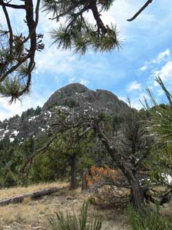
The trail swings back east and then climbs to a vista where we can see Mt. Wrightson. There are a few patches of snow along the gullies near the top. The detour trail continues along the hillside until it comes to the Chuparosa Inn where it drops into the stream bed. All along the way are signs warning about entry into the construction zone and a potential $1000 fine. Our trail dollars at work building the parking lot. The way is marked by blue and pink flags and is pretty rough climbing over and around boulders. After a half mile, the trail crosses the stream and joins in the original trail.
We now have two choices. One is the older Baldy trail which is 5.4 miles/4000ft to the top or the Super Trail which is 8.0 miles/4000ft. Since we have the extra mileage due to the constructions, we go for Old Baldy trail.
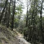
The trail climbs up traveling along the old water pipes for the canyon residences. It is 2.2miles/1600ft to Josephine Saddle. The trees are interesting. Along the start are three different types of oak, Arizona white, Emory and silver leaf. Scattered throughout the oaks are also Alligator Junipers which are very striking. Their bark is black and knobby just like alligator skin. They stand about 6-10 feet tall with distinctive juniper needles and berries. Below them are yuccas and a few hedgehog cactus. There are few flowers other than what looks like a white philox. As the trail gets closer to the saddle, it gets steeper and switchbacks in the dark forest before emerging onto Josephine saddle.
The Super Trail joins up for a short distance at the saddle. There is a memorial to three Boy Scouts who died in an early November snow storm in 1958. Off in the distance is the summit of Mt. Wrightson which is still 3 miles/2400ft away.

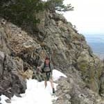
The trail now goes north. The forest is open and we hike through needles of Apache and White Pines. The forest is also very quiet. We only hear an occasional small plane passing overhead. No birds; not even a jay. We climb out of the forest and have wider views down over Green Valley and across to Mt. Hopkins. We leave behind the pine forest and enter an area of deciduous low oaks and aspens. We come across our first patches of snow. They are easy to cross other than being somewhat icy on the edge. We try to skirt along the sides when possible. Most of the plant life is still asleep. Above us towers the rocky side of Mt. Wrightson as we switchback up and back passing Bellows Springs.
At around 11am, we reach Baldy Saddle at 8,800ft. Just under a mile left to go! We head north and the trail switch backs up out of the forest. We cross several patches of snow. Again, nothing too difficult to cross especially with the hiking poles. The trail swings to the south and enters and area of waist high oaks and white rocks. Above, you can see the edge of the top not far away. Soon we are on the top at 9,450Ft shortly before noon.
It is still overcast and the wind is cool. I put on a top and look around. I was hoping to find the summit register or a geographic survey marker but no luck. There is the foundation of the lookout. But the views. Wonderful 360 degrees views. South is Tucson and the Santa Catalina Mountains. To the West is Baboquivari and Kitts Peak. You can just make out the white observatories at the top. To the East are the Chiricahua mountains and Miller Peak. To the south is Nogales and Mexico.
 We had the summit to ourselves. We grabbed our sandwiches and had lunch. A few moments after lunch, two women joined us at the top. They were both from Tucson so we talked about living in Tucson and hiking. One had done Mt. Whitney so I got some tips. Shortely after that we were joined by several other parties and we decided it was time to leave. By now the sun had come out and the sky was turquoise blue. Going downhill is always harder for me. We passed a few parties going up but not many. Most people do like us and start early to summit before it gets to hot. After we left Josephine Saddle, my knee started acting up. My iliotibial band on the side of my knee gets quite painful. I had to stop once or twice to sit and stretch it. Both of us started getting a couple of hot spots on our feet. I ended up with one blister. Not bad. By 4pm, we were back to the parking lot. 4hours 30 minutes up and 3 hours 30 minutes down. Total mileage 14 miles, elevation gain, 4500ft. Yahoooooo! Mt. Whitney here I come.


Hi Marta,
I enjoyed reading about your hikes… especially having lived here my entire life. Madera Canyon is a beautiful place to visit. Gerhart forwarded me your website. He has been to a lot of different places too, and he takes beautiful pictures. It was very nice to meet you. I’m glad you enjoyed your visit. It has been nice and cool since you left! Happy Easter! RuthAnn