Little Lakes Valley

Chickenfoot Lake
July 9, 2008 – Mammoth Lakes California
California Road Trip and Family GTG
Day 4 dawned and I glanced out the window to discover the smoke from the fires north of Tahoe had drifted along the eastern Sierra slopes. I could barely see mountains.
We decided to return to Rock Creek area to hike up Little Lakes Valley to Chickenfoot lake. We had been in the this area in 2004 and hiked to Mono Pass when we were training for Mt. Whitney. The trail to Mono Pass starts at the same trail head. We could see the valley from the trail and wanted to return some day and explore the area.
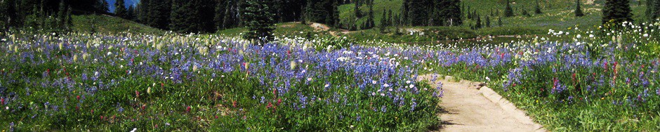
We drove south on Hwy 395 about 15 miles to Tom’s Place and turned in Rock Creek Road. This road climbs up in a short 10 miles along creek lined with aspens and rock slopes filled with brilliant tall red penstemon, lupine, white prickly poppy (argemone) and coyote mint to the trail head past Rock Creek Lake. The elevation at the trailhead is 10,300ft. It seems strange to be able to drive to a point higher than Camp Muir.
The area is called Mosquito Flats and it is well named. I was prepared this time and covered my body with deet. The flowers started right at the parking lot. The area is white sandy volcanic soil and can be hot but the day was fortunately overcast. The trail climbs along Rock Creek, a favorite of fly fishermen and is surrounded by mountains. At .5 miles, you reach the junction with the trail to Mono Pass. Keep left and head towards Morgan Pass. Shortly after the junction, you reach a short rise and can see the valley laid below and ringed with tall peaks.
The valley is a chain of interconnected lakes. You pass the first lake, Mack Lake and then climb a short bit to the next lake, Marsh Lake and soon reach Heart Lake. Along the lakes you pass wet grassy meadows with willows and elephant heads. Leaving the lake, you climb up through rock slope filled with gorgeous white and blue columbines before coming to Long Lake with the peaks getting closer. Past Long Lake, you climb up to higher meadows. The trees have shortened and the rocks are granite. There is a turn off to Chicken Foot lake which is more alpine. It is ringed on one side by small pines and on the other side by the granite face of Mount Morgan. The meadows along the shore are filled with a very cool form of kalmia. It was our destination for the day (5.8 miles RT, 800ft elevation gain, 11,100 FT high point).
Click through for more pictures.
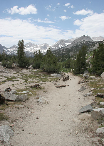
The trail starts dusty with the high Sierra peaks in the distant
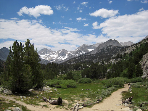
Soon little lakes will appear

Heart Lake is one of the first.

Looking toward Morgan Pass

Gnarled trees we passed along the way

Long Lake

Chickenfoot Lake

Chickenfoot Lake looking toward Mt. Morgan

Sierra Columbine – Aquilegia pubescens

Lovely Kalmia found along the lake shore – Bog Laurel – Kalmia microphylla