Cedar Butte Trail

I don’t know why it has taken so long for us to do this hike. It is located just across from Rattlesnake which is one of our favorite hikes in the winter. Cedar Butte is a small knob just east of Rattlesnake Lake near North Bend. It is lower than Rattlesnake Ledge – 1800 ft but the trail is about the same workout. It is 2 miles to the top and a 900 ft elevation gain.
The drive from home takes just about 1 hour. We usually try to get out before 10 or 11 at latest. The southbound Express Lanes are usually open until 11 so we can quickly get through downtown Seattle and head east. The forecast was for partial sun and a high of 60. 60 degree! on the first of March! We took the just after North Bend (home of the Snoqualmie Casino and a large Outlet mall). The parking lot was pretty empty. Probably not that unusual for a winter Monday.
The trail starts at the Iron Horse State Park. The first mile is along the John Wayne Trail – a rails-to-trail from the old Chicago, Milwaukee, St. Paul and Pacific Railroad. It starts at Cedar Falls and goes over Snoqualmie Pass to Easton and beyond. We have cross country skied on part of the trail south of Cle Elum. A great resource for many different sports.
Follow the John Wayne Trail for about a mile until it crosses a bridge over Boxley Creek. Look to the south for a trailhead for Cedar Butte. The trail starts up and soon comes to a junction. Here you have a choice; go to the right and you will reach the summit in about 1 mile with a good grade or go to the left and save a 1/2 mile distance but be prepared for a steeper climb.
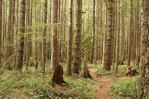
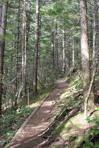
I prefer a gentler trail on the downhill so we decided to go the shorter steeper trail to the left. It continued through the cut forest for a short distance and the it entered a very magical forest. It seemed as if everything had been airbrushed in brilliant green. It was the spring growth of moss. There was long tendrils of moss on some of the branches of the maples. The trunks of the taller evergreens were sprayed with a fine coat of moss. It gave it a surreal feeling of being in a room that had just been spray painted.
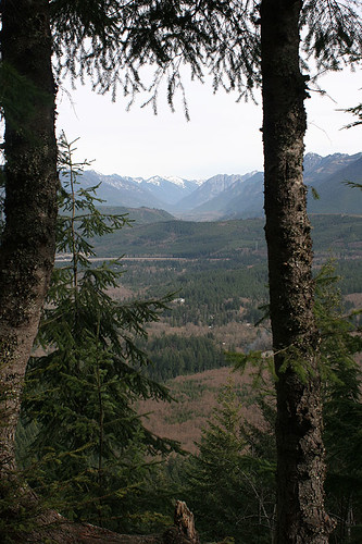
Soon we reached the Saddle Junction where the trail to the right rejoins and we headed up the final 1/4 mile or so to the summit. The switchbacks took us to the top while views of Rattlesnake and the I-90 corridor peaked between the trees. The summit was a little bit of a disappointment. The trees have grown up blocking much of the view. You can still see up the Middle Fork of the Snoqualmie Valley bounded by Tenerife Mountain on the West and Mailbox Peak on the East. It took us just a bit over 1 hour to make the two miles. Not too bad.
We headed back down quickly passing the Saddle Junction and heading on the other longer trail. We entered into the magical moss forest again. The wind was blowing and creaking the trees above our heads. All was quiet besides the rustling of needles from the wind. We passed the Boxley Blowout where in 1918 the City of Seattle’s Cedar Dam burst and blew out the area. There was not much to see today so we continued on and we were soon back to the John Wayne Trail.
We made it back to the car shortly. The weather had continued to be warm but cloudy. We could see some signs of Spring in the forest; the brilliant green of the moss, the young leaves of fox glove, a few bright pink blossoms of thimbleberry, blossoms of Indian Plum – but there was still a lot asleep. No sign of trilium, no fiddleheads of bracken ferns, no maple racemes. It may feel like Spring in the city but it is still mostly sleeping in the forest.
Here are some photos of the hike.

Trailhead at Iron Goat State Park

The start of the John Wayne Trail

Rattlesnake Lake and a portion of Rattlesnake Mountain in the distance


Wow, that mossy forest looks like something in a fairy tale. What a cool place.
Gorgeous shots, Marta.
Marta, lovely photos. I feel as if I was communing with nature along with you – without the workout! Mahalo, m
Check the web page made me chuckle.
As I looked at your pictures I felt as though I was on a winter walk. I even got a bit chilly!
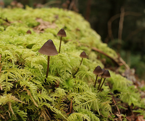
OMG, Marta! How did you shoot that mushroom picture? It looks like it is in 3-D!
Wow, what an amazing place! I love hiking, but we don’t have many good trails in Nova Scotia, or at least not many that are of any length. We do have some wonderful shorter trails. Your photos are stunning, I LOVE the eerie mossy forest!
Amazing moss! I cracked up though at the check the web page sign. And where would the connection be in the woods? 🙂