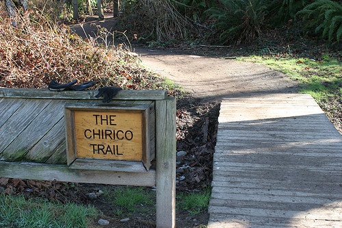
Tiger Mountain Poo Poo Point via Chirico Trail
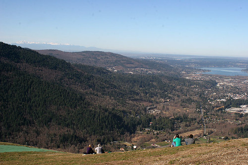
Overlooking Bellevue and Lake Sammamish
What glorious weather we are having for February! Brilliant sunshine and temperatures almost to 60 degrees. Perfect weather for a winter hike.
Tiger Mountain is just east of Issaquah. It encompasses more than 70 miles of trails ranging in a variety of steepness. The mountain is managed by Department of Natural Resources and the trails are maintained by the Issaquah Alps Trails Club. It is a perfect location to hike in the winter since the many of the high points are less than 3000 feet. You can run into snow and ice during cold stretches but with this year’s El Nino weather, the area has been snow free most of the year.
The trails are a variety of difficulty. We used the heavily used Tiger Mountain 3 trail and Section Line trail from the High Point trailhead when we trained for Rainier and Whitney. But we have never explored the other regions. Poo Poo Point has been on my list and we decided to try it.
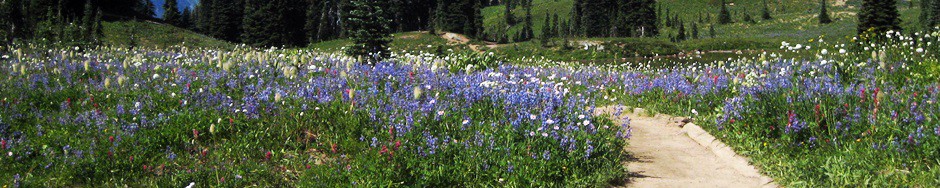
The name is pretty unusual. It turns out to have been named for the sound the train whistles made passing by. Poooo Pooooo… Today the point is used by hang gliders. It has has magnificent views to the South and West. Ranging from Mount Rainier and Maple Valley towards the south, Bellevue and the Olympics to the west and Whitehorse and Mt. Baker.
There are two typical ways to reach Poo Poo Pt. The first trail starts at the Issaquah High School and is appropriately called the ‘High School Trail’. This trail is over 4 miles one way and an elevation gain of 2200 feet. The second trail, Chirico trail, is more direct. It is used by the hang gliders to haul their gear to the take off spots on Poo Poo Point. It is great condition with many flat rock steps but it does seriously climb 1500 feet in just over 1.5 miles. It is a great place for a quick work out.
It takes about 45 minutes to drive to the trail head from North Seattle. Take the Front Street Exit (#17) off I-90 and pass through the charming old downtown of Issaquah. Front Street becomes the Issaquah-Hobart Road. The trail head is at the landing area on the left side of the road near SE 113th Street. There is a small parking lot and we lucked out and found a parking spot. There is limited parking along the road with many No parking or stopping signs.
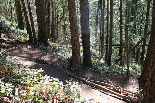
The trailhead starts across the landing field through cedar forest. It starts climbing immediately. It alternates between evergreen forests and stark gray forests of alder. The Indian Plum (Oemleria cerasiformis) was just starting to bloom and I spotted brilliant red blossoms of an early flowering currant (Ribes sanguineum). The trail is in excellent condition although it is narrow. There is a small viewpoint after about 1 mile and the trail then continues to switchback. Just before the top, there is a web of different trails to the south launch. They all go to the top. We choose to follow the switch backs instead of plowing straight up to the top.
What a beautiful view. Mt Rainier in the distance and Maple Valley and the Cedar Valley below. The warm sunshine felt great on a mid-February Friday. We rested a bit and enjoyed the view and sun before heading up to the North launch just a short distance further.
It was a little weird to see astroturf but it looks like it does protect the launch area. From the North Launch area, we had a over 180 degree vista starting south to Mt Rainier. The Olympics, downtown Bellevue and Lake Sammamish were at our feet. Over our shoulder to the North was Mt. Baker. It was a little hazy but warm. Wonderful hike. Wonderful day.
Trailhead
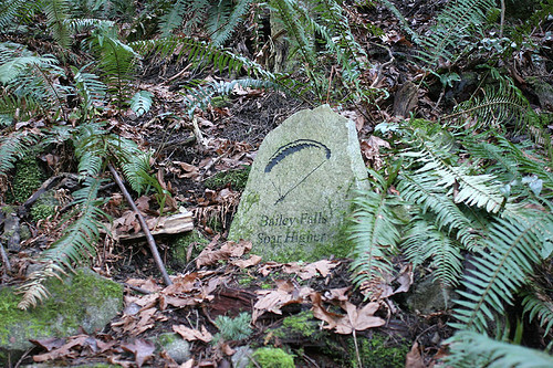
Hang glider memorial

Trail climbs steeply but is in great condition
Switchbacks

Winter Alder grove
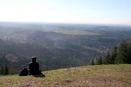
South launching site – over looking Maple Valley
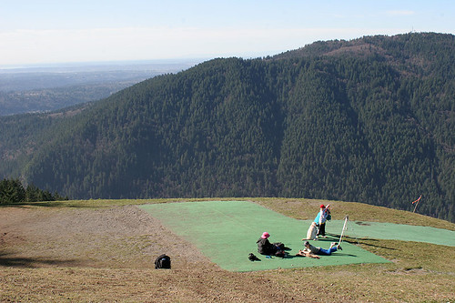
North launch site
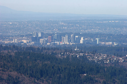
Bellevue via telephoto from Poo Poo Point
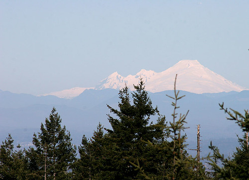
Mt Baker in the distance
Scenic vistas like that make any hike worth the effort! m
Stopping in to do some catch up (we were in NZ for 12 days). Looks like a great hike, and it looks like the weather was perfect. The trail seems like it is in good condition, and the views well worth the effort!